 BIM Services
 Architectural
 Structural
 MEP
MEP Facade
 Industrial
Introduction
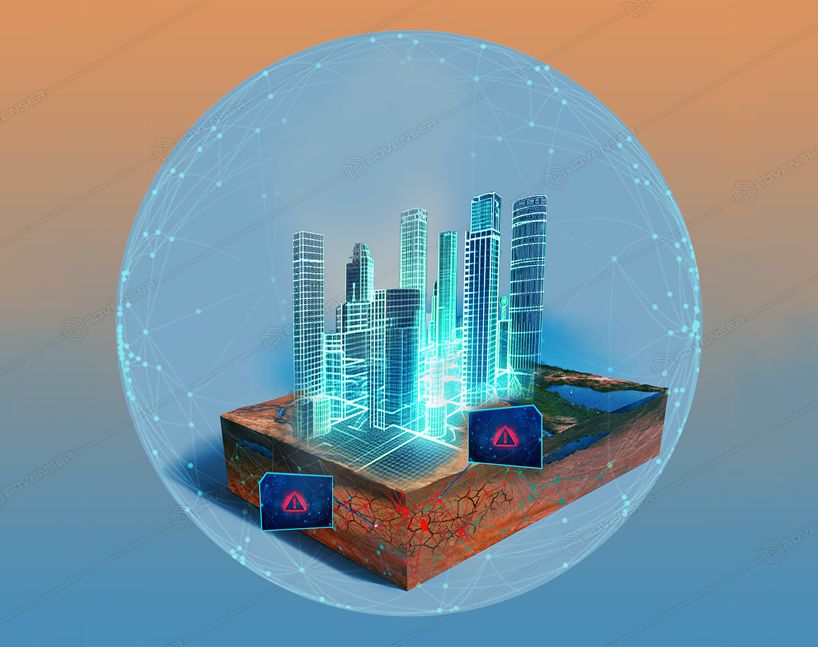
The integration of Building Information Modeling (BIM) and Geographic Information Systems (GIS) is revolutionizing the Architectural, Engineering, and Construction (AEC) industry, enhancing efficiency and pushing the boundaries of what is possible, thereby ensuring success in a highly competitive landscape.
BIM–GIS integration enables AEC professionals to streamline workflows, improve collaboration, and make informed decisions. With access to real-time data, teams can visualize complex scenarios and mitigate risks before they occur—leading to faster project completion, reduced costs, and enhanced sustainability. This innovative approach is transforming urban planning and infrastructure development through more accurate designs, efficient construction processes, and superior results.
The Importance of BIM in the AEC Industry
Building Information Modeling (BIM) allows the creation of rich digital representations of buildings and their physical/functional characteristics. Going beyond traditional 2D drawings, BIM supports visualization and analysis across the entire building lifecycle—from design through maintenance. It improves stakeholder collaboration by reducing drawing conflicts and versioning issues, provides real-time updates to keep teams aligned, and enhances design accuracy via 3D simulations that reveal issues early—saving time, cost, and improving final quality.
The Role of GIS in the AEC Industry
Geographic Information Systems (GIS) capture, analyze, and present spatial data that informs design and construction. By overlaying terrain, land use, utilities, environmental constraints, and more on digital maps, GIS helps architects and engineers make context-appropriate decisions. It identifies risks such as flood zones or soil instability, supports urban planning and infrastructure development, and enables data-driven resource allocation and future growth strategies—fostering sustainable, livable cities.
Benefits of Integrating BIM and GIS
- Comprehensive visualization: BIM delivers detailed 3D models; GIS adds spatial context for complete situational awareness.
- Informed decision-making: BIM supports design/construction decisions; GIS provides spatial analytics for environmental and infrastructure impacts.
- Optimized site selection: BIM aids planning fidelity; GIS evaluates topography, climate, and constraints to pinpoint optimal sites.
- Streamlined collaboration: BIM coordinates stakeholders; GIS enriches communication with geospatial data and analysis.
- Accurate asset management: BIM hosts detailed asset data; GIS tracks assets spatially for lifecycle operations.
- Cost & time savings: BIM reduces rework via early clash/risk detection; GIS optimizes schedules using geographic insights.
- Sustainability & energy efficiency: BIM models sustainable strategies; GIS analyzes environmental context to cut carbon and energy use.
- Efficient urban planning: BIM supports urban design; GIS integrates city-scale datasets for holistic planning.
- Disaster & risk management: BIM enables resilient design; GIS assesses hazards and supports preparedness.
- Facilities management data: BIM provides as-built models; GIS combines spatial/building data for a holistic O&M view.
BIM and GIS Integration by Advenser
Discover more in part two of this series: “Navigating BIM and GIS Integration: Case studies, best practices, and cutting-edge tools.”


