 BIM Services
 Architectural
 Structural
 MEP
MEP Facade
 Industrial
BIM for Infrastructure Projects
Advenser has established itself as a reliable BIM service provider for a diverse range of infrastructure and civil construction projects. We have consistently delivered tailored services to meet the specific requirements of our clients globally. Our BIM services empower clients to leverage advanced Building Information Modeling (BIM) tools and processes for every stage of their projects, from design and construction to maintenance, ensuring efficient and cost-effective outcomes.
We assist our clients in harnessing the full potential of BIM to optimize the planning, design, construction, and management of civil infrastructure projects through enhanced collaboration across disciplines. Our expertise, combined with the latest technologies and tools, allows project teams to streamline their workflows, mitigate risks, and improve project delivery.
Our range of solutions for Infrastructure Projects includes:
Utility Layout and Coordination
We offer comprehensive BIM services for infrastructure projects, including new constructions, expansions, and renovations, across:
We offer comprehensive BIM services for infrastructure projects, including new constructions, expansions, and renovations, across:
Roads and Highways
Bridges and Tunnels
Railways and Transit Systems
Airports and Runways
Ports and Harbors
Water Supply and Drainage Systems
Dams and Reservoirs
Power Transmission and Distribution Networks
Urban and Rural Development Projects
Beyond BIM modeling for civil and structural components, we provide BIM clash coordination, detailed construction drawings, and scan to BIM services for all infrastructure trades. We also specialize in road design, bridge modeling, and utility layout using cutting-edge software like Civil 3D and InfraWorks.
We Team up With:
Civil Contractors
Civil, Structural & MEP Engineers
General contractors
Infrastructure Project Managers
Municipalities and Government Agencies
Surveyors and Geotechnical Engineers
Project Owners
Featured Projects

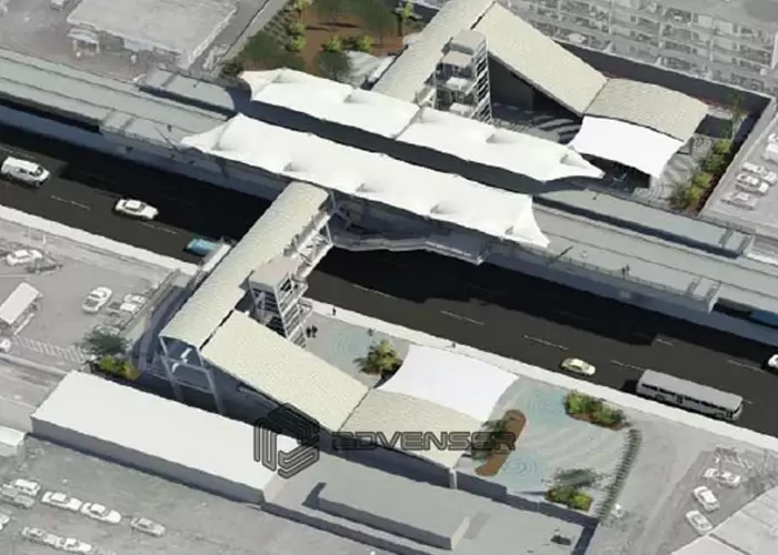
Metro Station, Canada

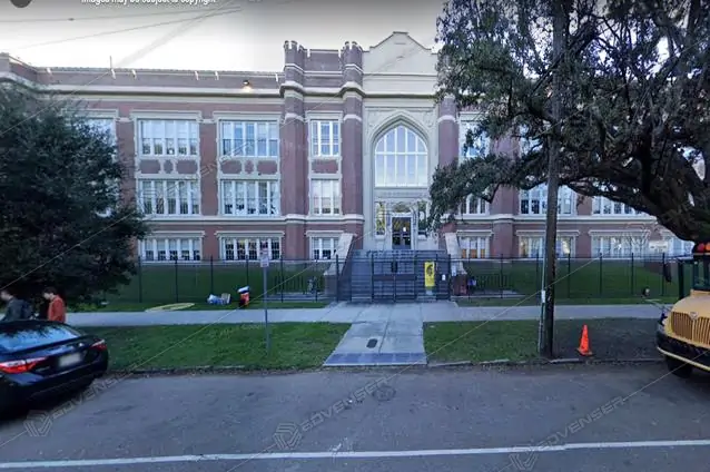
Public Transportation, USA

Metro Railway Platform, USA

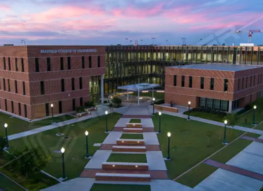
Transportation Infrastructure, USA
Our Software Expertise:

Civil 3D

AutoCAD MEP

Formlt Pro

Fabrication CADmep

Building Data

Tekla

RebarCAD

InfraWorks

Autodesk Docs

Insight

Advance Steel

Construction Cloud

STAAD.Pro

RGS REBAR

Revit

Navisworks Manage

3ds Max

AutoCAD Plant 3D

MagiCAD

Solid Edge

Rhinoceros

ReCap Pro

BIM Collaborate Pro

Inventor

Dynamo

LogiKal

Trimble EC CAD, Field Technology
Frequently Asked Questions
Can you deliver accurate terrain and alignment models for roads or rail corridors?
Yes. We provide precise grading, cut-fill calculations, alignment layouts and terrain visualization to help you plan earthworks and alignments with real-world data.
What deliverables do we get working with Advenser on infrastructure BIM?
You receive coordinated BIM models, shop/fabrication drawings, alignment & grading maps, utility routing plans, clash reports, 4D/5D scheduling and cost data, and as-built / digital-twin documentation ready for operation or maintenance.
Do you support utility network modeling and underground services?
Absolutely. We model all underground utilities — water, sewage, storm-water, drainage, telecom, power conduits — alongside civil and structural elements for full coordination.
Do you support upgrades, expansions or renovation of existing civil works?
Yes. Through Scan-to-BIM or existing drawings, we accurately capture existing conditions and plan expansions or retrofits with minimal disruption.
How does BIM help control project cost and schedule for large infrastructure work?
By removing design conflicts early, optimizing material quantification, and enabling better sequencing planning, BIM helps avoid delays and overruns — giving you predictable budgets and timelines.
How does Advenser help avoid on-site surprises during infrastructure construction?
We build fully coordinated 3D models that integrate terrain, utilities, civil and structural works — identifying clashes and design conflicts early so construction goes smoothly on site.
What’s needed from our side to start an infrastructure BIM project with Advenser?
We need survey/topography data, existing drawings (if any), project scope (new build, upgrade, utility network, etc.), alignment data or layout briefs, utility requirements, and any regulatory or compliance standards.

