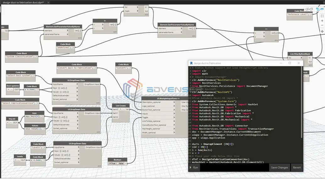
BIM Services
 Architectural
 Structural
 MEP
MEP Facade
 Industrial
Not many years ago, people who thought they were being constantly watched by someone or something were labelled paranoids. But that is not the case right now; times have changed and we live in a world where there are flying cameras watching over human activities. We have seen these flying cameras during sports events, concerts and even during some wedding receptions. You could call it a plane without a pilot or a flying remote controlled toy camera but how do we define them in a surveying and engineering context? When technically elaborating, they may be identified as tools that capture beneficial digital data and images from a different perspective. These systematic images captured are then used to create a 3D model, point cloud or a Digital Terrain Model (DTM). The DTM statistics are extremely useful for the generation of 3D renderings of any location in a described area and they could come handy for engineers working in various fields like geodesy & surveying, geophysics, and geography.
All this cumulatively contribute to elevated efficiency levels during the different phases of construction engineering. Construction is a one of a kind industry, where even such small gains in efficiency and flexibility can reap billions of savings. With that in mind, it’s no real surprise that the engineers are slowly embracing the so-called “Drone Revolution”. Now, UAVs are starting to dominate all the 4 stages of Architectural engineering, namely; preconstruction stage, construction stage, post construction stage and finally and most significantly the ongoing safety maintenance stage.
Preconstruction Stage
During preconstruction stage, the project is in its budding stage and the whole design is nourished slowly and carefully by the architects. The paramount activity during this stage is land survey documentation. Drones can provide us with precise and speedy overviews of large sites and high-risk areas thereby ensuring that the documentation of land condition is precise. This data can further be used for scheduling and planning of the construction activities which are to happen in the location.
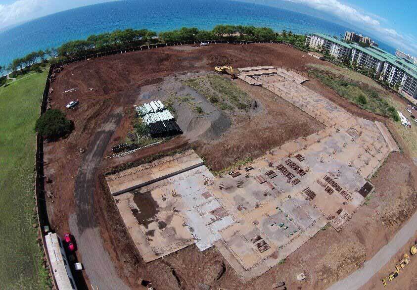
Site survey using drones
In conventional point cloud methods, there are possibilities of uneven topography due to certain occlusions in the sight, but the bird’s eye vision advantage of drones ensure generation of data across an entire region with the identical consistency in accuracy and density and this data can be even used to create a Building Information Model (BIM) which clearly shows how exactly our building is going to look like after the whole construction process is done, which is very beneficial from the designer’s point of view.

Using Drones for land and site survey
Construction Stage
During the construction stage, there are innumerable difficulties to be dealt with. One such difficulty is the proper documentation of the project progress schedule. Usually, there would be a site manager traversing around the site capturing photographs at random points and then preparing the whole site report based on these limited photographs. Needless to say, the report would be defective and insufficient. But with the introduction of UAVs into the construction industry, a series of high definition aerial shots and videos can be easily captured so as to get a better insight into the progress that has occurred without actually being on-site. The real time data acquired by light detecting sensors mounted on the Drones can help create point clouds or Building Information Models (BIMs) which can be directly fed into Autodesk’s program line such as BIM, Inventor, AutoCAD and Revit for early damage detection procedures, quality management exercises and other asset evaluation techniques. The point clouds or Building Information Models (BIMs) can be further used to retrieve relevant information at the wish and will of the engineer.

Acquiring high definition aerial shots with Drone
Post-Construction Stage
The post construction stage can be just as problematic as the construction stage. Evaluation of high-rise buildings and other complex structures are often a tedious task with the naked eye. Inspecting a building roof using UAV multi – rotor system is an economical and secure way than by using conventional methods. Like laser systems, drones can also be used to capture aerial thermal images to locate the potential hot and cold spots in a building but their 4K quality gives them an upper hand over the low-quality laser scanned images. This aesthetic dominance the drones have over conventional laser methodologies are certainly a boon while considering a marketing angle as well. There’s undeniably no better way to advertise a new project than a top to down view from a bird’s eye point of view. An engaging walk through project video is a delightful way to introduce key personnel to the project and get them on board.

Thermal images are obtained which can later be used for quality inspection
Ongoing Safety and Maintenance Stage
The role of UAVs in implementing a safe and secure work atmosphere is the one salient feature that stands out and this simply is the reason why drones have become a household name for safety inspectors in large construction sites. Often in multimillion projects, the officer in charge may not always be around and this is where the live video coverage of the drones strike gold. The live feeds can be accessed by the superiors easily even from a remote location, thereby enabling routine asset inspections, fatigue and damage evaluations and condition surveys at all times. Keeping in mind all this, it is no wonder that UAVs are nicknamed the new onsite “BOSS”.

Using Drones as a site supervisor
As research has demonstrated, in the coming years we are undoubted to witness drones spearheading the construction industry. With our eyes and ears virtually in the sky, it’s already quite effortless to identify the contradictions in the ongoing process and in addition to that we can know how aesthetically appealing the buildings are coming up. The control and planning aspects of the construction process have also witnessed considerable changes which were practically unfeasible a few years back. The money and time saved with the support of drones are going to be immeasurable in the future. In short,
Drones can be used for:
- Land survey and site inspection during pre-construction stage
- Building Information Modeling (BIM) and Point cloud scanning
- Marketing and promotional photography during and after construction
- Monitoring and tracking onsite activities thereby ensuring accurate workflow
- Ensuring routine asset inspections and safety measures at all times
Thus it is safe to claim that the notion of ‘technology integrated construction’ has advanced by leaps and bounds with the intervention of drones into the construction industry.