Introduction
The integration of Building Information Modeling (BIM) and Geographic Information Systems (GIS) is revolutionizing the Architectural, Engineering, and Construction (AEC) industry, enhancing efficiency and pushing the boundaries of what is possible, thereby ensuring success in the highly competitive industry.

BIM and GIS integration allow professionals in the AEC sector to streamline workflows, improve collaboration, and make informed decisions. This integration allows architects, engineers, and construction stakeholders to access real-time data, visualize complex scenarios, and mitigate risks before they occur. This leads to faster project completion, reduced costs, and enhanced sustainability. This innovative approach is transforming urban planning and infrastructure development, ensuring more accurate designs, efficient construction processes, and superior results.
The Importance of BIM in the AEC Industry
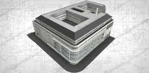
BIM is a crucial tool in the AEC industry, enabling professionals to create a digital construction of buildings and provide detailed information about their physical and functional characteristics. BIM goes beyond traditional 2D drawings, allowing architects, engineers, and construction teams to visualize and analyze the entire life cycle of a building, from design to maintenance. It improves collaboration among stakeholders, eliminating the need for multiple versions of drawings and reducing errors or conflicts. BIM also offers real-time updates, ensuring all team members are working with the most up-to-date information. Additionally, BIM enhances design accuracy by allowing architects and engineers to create 3D models that simulate building behavior under various conditions, enabling early identification of potential issues and necessary adjustments before construction begins. This not only saves time and money but also improves the overall quality of the final product.

The Role of GIS in the AEC Industry
Geographic Information Systems (GIS) have long been used in various industries to capture, analyze, and present spatial and geographic data. In the context of the AEC industry, GIS plays a crucial role in providing valuable insights into the physical and environmental aspects of a project site.
GIS is a powerful tool that aids professionals in analyzing terrain, land use, utilities, and other factors that influence the design and construction process. By overlaying this data onto digital maps, architects and engineers can make informed decisions and optimize design for specific contexts. GIS also helps identify potential risks and challenges, such as flood zones and soil stability, before construction begins, reducing delays and costly surprises. It also plays a crucial role in urban planning and infrastructure development, allowing city planners to allocate resources, design efficient transportation systems, and plan for future growth. GIS integration in the AEC industry promotes a holistic, data-driven approach to urban development, resulting in more sustainable and livable cities.
Benefits of Integrating BIM and GIS
Comprehensive Visualization
BIM/VDC provides a 3D digital representation of the building, while GIS adds a spatial context, offering a complete visual understanding.
Optimized Site Selection
BIM aids in detailed planning, and GIS assists in selecting optimal sites based on geographical factors like topography and climate.
Streamlined Collaboration
BIM facilitates collaboration among stakeholders, and GIS enhances communication by integrating spatial data and analysis.
Sustainability and Energy Efficiency
BIM supports sustainable design, and GIS analyzes environmental context for enhanced energy efficiency and a reduced carbon footprint.
Efficient Urban Planning
BIM aids in urban planning and design, and GIS integrates spatial data for comprehensive urban planning considerations.
Informed Decision-Making
BIM enables informed decisions during design and construction, while GIS provides spatial analysis tools for assessing environmental impact and infrastructure considerations.
Accurate Asset Management
BIM provides a detailed database for maintenance, and GIS manages spatial data for effective asset tracking.
Cost and Time Savings
BIM reduces rework by identifying issues early, while GIS optimizes project timelines through geographical insights.
Disaster and Risk Management
BIM assists in creating resilient designs, and GIS provides spatial analysis for assessing risks and aiding in disaster preparedness.
Comprehensive Data for Facilities Management
BIM generates detailed as-built models for ongoing facilities management, and GIS integration offers a holistic view of spatial and building data.
Discover more about BIM And GIS Integration in the next part in this two-part article: Navigating BIM and GIS Integration: Case studies, best practices and cutting edge tools